Array
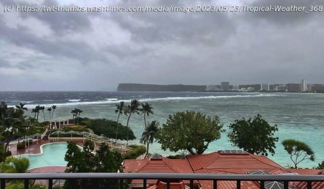
Typhoon Mawar aimed its fury at the tiny U.S. territory of Guam on Wednesday as residents with nowhere to go hunkered down to face the devastating winds and torrential rains from what was expected to be the worst storm to hit the Pacific island in decades.
The U.S. military sent away ships, residents stockpiled supplies and anyone not living in a concrete house was urged to seek safety elsewhere ahead of the typhoon, which was forecast to arrive as a Category 4 storm with winds of 140 mph (225 kph) but could possibly strengthen to a Category 5, the most powerful. The last time a Category 5 directly hit Guam was 1962.
Forecasters at the National Weather Service office in Guam said they were seeing “almost whiteout conditions” at their office and hearing low rumblings and shaking shutters and doors as the storm intensified Wednesday afternoon.
Lightning had become an increasing threat as conditions continued to deteriorate into the evening, the weather service reported. And an extreme wind warning was in effect for northern Guam for extremely dangerous hurricane winds.
“Stay inside. Trees are coming down; power lines are coming down,” said Brandon Aydlett, a meteorologist with the service. “Everything is changing — it is too dangerous to be outside.”
Many communities on the 212-square-mile (549-square-kilometer) island had lost power by the afternoon and some to the south had lost water service. A flash flood warning was issued for the entire island as forecasters predicted as much as 25 inches (64 centimeters) of rain in addition to a life-threatening storm surge of 4 to 6 feet (1.2 to 2 meters).
Ahead of the storm, Guam Gov. Lou Leon Guerrero ordered residents of coastal, low-lying and flood-prone areas of the territory of over 150,000 people to evacuate to higher elevations. The highest point on the island is Mt. Lamlam in the southwest at 1,334 feet (406 meters). But much of the beachfront tourist district of Tamuning, where many resort hotels are located, is close to sea level.
In low-lying Agat along the southern coast, resident Reuel Drilon began preparing Friday and spent the weekend tying down patio furniture and trash containers. Nearly every home in the village, he said, has a mango tree — which officials warned could be ripped from the ground and become roadblocks and deadly flying projectiles.


