Japan is facing the risk of a possible «megaquake,» which could cause a dangerous tsunami.
Japan is facing the risk of a possible «megaquake» in the near future, following a 7.1-magnitude earthquake that occurred off the southern coast on Thursday.
If such a megaquake were to occur, it could potentially cause a dangerous tsunami that could put thousands of lives at risk.
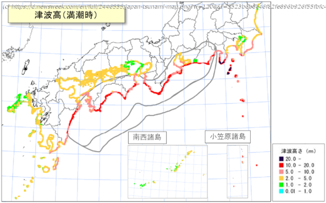
Japan’s meteorological agency has published a map showing which parts of the country could be struck by a tsunami in the event of a megaquake in the Nankai Trough.
The color-coded map shows the potential tsunami height across the region, with some areas facing waves as high as 20 meters, or approximately 65 feet.
The areas most at risk are marked as yellow or red. In yellow areas, waves could reach between 2 and 5 meters, or around 6 to 16 feet.
In red areas, waves could reach between 10 and 20 meters, or around 33 to 65 feet.
The areas at risk include parts of Shizuoka Prefecture through Miyazaki Prefecture, which could experience a seismic intensity of 7, with surrounding areas also affected.


