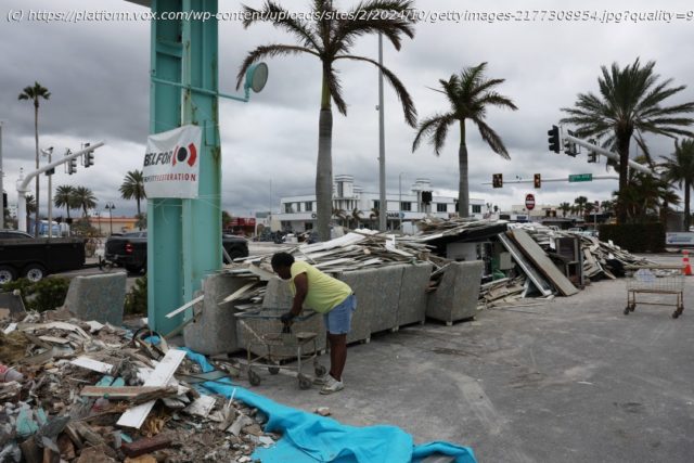
As Hurricane Milton makes landfall, Florida prepares for uncharted territory.
Just weeks ago, Hurricane Helene devastated multiple states in the southeastern US. Over 230 people were killed because of the storm, and that number is likely to go up as the search for missing people continues. Entire homes, streets, and towns across the Carolinas, Georgia, and Florida have been torn apart. Plans for rebuilding are bound to be a slow struggle.
Now, Florida is primed to face disaster once again — before it’s even had a fair chance at recovering from the last one.
On Wednesday night, Hurricane Milton, currently a Category 4 storm, will make landfall on Florida’s west coast. While forecasters say it’s likely to weaken a bit before reaching Florida, government officials are ordering millions of people in over a dozen counties to evacuate.
“I can say this without any dramatization whatsoever: If you choose to stay in one of those evacuation areas, you are going to die,” said Tampa Mayor Jane Castor.
The Tampa Bay area, in particular, is in serious trouble. The land is prone to flooding and storm surges caused by hurricane season. Most recently, Hurricane Helene caused record storm surges for the city.
But now, this region may be right in Milton’s path. The last time a hurricane hit the area directly was 1921 — it demolished homes and killed eight people. Back then, Tampa Bay was home to 65,000 people. Today, the population is 3.1 million. While the exact location of where Milton will make landfall is still uncertain, even on the day of its arrival, it’s clear that there is much, much more to lose this time around.
The back-to-back phenomena between Hurricanes Helene and Milton spells out disaster for communities in Florida that just barely started to rebuild and recover from Helene’s damage. As Hurricane Milton imminently approaches, coastal residents and their local governments are scrambling to move the heaps of debris off the streets, which can become dangerous projectiles if swept up by the coming storm, which is currently forecasted to make landfall as a Category 4. (Hurricane Katrina, for example, made landfall as a Category 3). Some towns are still getting back up on their feet from when Hurricane Debby, a large Category 1 storm that wreaked havoc by continuously dumping heavy rain over parts of Florida and flooded towns, hit back in August.
Florida is no stranger to extreme weather, or even weather disasters happening one after the other. But all of the above context makes this situation feel terrifyingly different.
“You could call it unprecedented, because you can take a similar meteorological setup, a similar tropical magnitude hurricane in a similar physical environment, but with more people and infrastructure — that is not something we have necessarily seen in the more recent, modern time,” says Emily Powell, the assistant state climatologist for the Florida Climate Center and program manager of the Florida Building Resilience Against Climate Effects (BRACE) Program.
I spoke in depth with Powell to better understand the gravity of the situation and how communities are confronting this uniquely destructive moment for the millions of people in Milton’s path.
This interview has been edited for length and clarity.
I know you’re based in Florida, it’s where you do your work. How are you feeling as Milton is getting closer to making landfall?
Milton is projected to cause more destruction, more storm surge, higher storm surge levels, potentially higher rainfall rates in places along the west Gulf Coast of Florida. These are places along the coast that will see really high, high levels of storm surge that we have not seen in those places in a long time.
Helene brought storm surges of between 6 and 7 feet roughly, in the west central parts of Florida.


