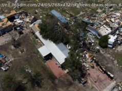
The National Hurricane Center said heavy rainfall from Tropical Storm Harvey will worsen flooding in southeastern Texas and southwestern Louisiana on Tuesday.
Aug. 29 (UPI) — Tropical Storm Harvey picked up some speed Tuesday afternoon as it made its way north-northeast toward Louisiana, the National Hurricane Center said.
The storm doubled in speed from 3 mph in the pre-dawn hours to 6 mph in the NHC’s 4 p.m. advisory. The center of the storm was located in the Gulf of Mexico about 55 miles south-southwest of Port Arthur, Texas, and 75 miles southwest of Cameron, La., moving about 6 mph toward the north-northeast.
Harvey has maximum sustained winds of 50 mph.
The NHC said Harvey is «crawling toward the coast, dumping catastrophic rains over southeastern Texas and southwestern Louisiana.»
A tropical storm warning was in effect from Port O’Connor, Texas, north to Morgan City, La., and a storm surge warning was in effect from Holly Beach to Morgan City, La. A tropical storm watch was in effect for Morgan City, La., to Grand Isle, La., and a storm surge watch was in effect from Port Bolivar, Texas, to Holly Beach, La. If Harvey’s wind speeds drop below 40 mph, it becomes a tropical depression.
Harvey is expected to generate another 6 to 12 inches of rain through Friday over parts of the upper Texas coast into southwestern Louisiana. In the Houston/Galveston metropolitan area, and in other parts of the upper Texas coast, rainfall accumulations could reach 50 inches through Friday.
South-central Louisiana should see from 5 inches to 15 inches of rain fall through Friday, and southeast Louisiana and coastal Mississippi and Alabama should see from 5 inches to 10 inches of rain.
The NHC said preliminary reports indicate a rain gauge in Cedar Bayou, Texas, recorded 51.88 inches of rain as of 3 p.m., breaking the existing Texas tropical cyclone rainfall record of 48 inches set in 1978 by Tropical Cyclone Amelia.
Tropical-storm-force winds extend outward from Harvey’s center up to 175 miles, primarily over water to the east and northeast, forecasters said.
Harvey weakened into a tropical storm as it moved inland Saturday, but the NHC said it was becoming an «extremely serious flooding event.» Harvey made landfall near Corpus Christi Friday night as a Category 4 hurricane. By 6 a.m. Saturday, it had weakened to a Category 1 hurricane with 90-mph winds. By midday, it was reclassified as a tropical storm.
Harvey was the first major hurricane to make landfall in the continental United States since Hurricane Wilma hit Florida in October 2005. It was also the first hurricane to make landfall in Texas since Ike in 2008.
The NHC is also watching Potential Tropical Cyclone 10, which packs maximum wind speeds of 45 mph and was 85 miles northeast of Cape Hatteras, N. C. The storm system was moving northeast at a speed of 24 mph.
All previous tropical storm watches and warnings for the coasts of South Carolina and North Carolina were discontinued in the NHC’s 5 p.m. advisory .
The cyclone, which could cause some flooding in coastal areas, is expected to move along the North Carolina coast before moving out to sea Tuesday night.
«The disturbance is forecast to strengthen at sea and become a hurricane-force extratropical low over the northwestern Atlantic Ocean by Wednesday evening. The system is not expected to become a
tropical cyclone., » the NHC said in a statement.


