Satellite images — taken from space nearly a year apart from each other — show just how devastating the flood damage is in Midland County.…
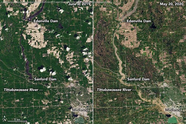
Satellite images — taken from space nearly a year apart from each other — show just how devastating the flood damage is in Midland County.
The record flooding this week destroyed homes, cars, roads, bridges and other property; damaged the sewer system, and forced 10,000 people to evacuate the area along the river, leaving many homeless and without electricity.
The natural-color images from Landsat 8, an American Earth observation satellite, depict the two mid-Michigan dams — Edenville and Sanford — that failed and the Tittabawassee River.
The Tittabawassee River hit a historic high Wednesday morning, rising above its previous record in 1986, and reaching 34.6 feet. Major flood stage is 28 feet.
Домой
United States
USA — Events Before and after: See destruction of Michigan flooding in satellite images


