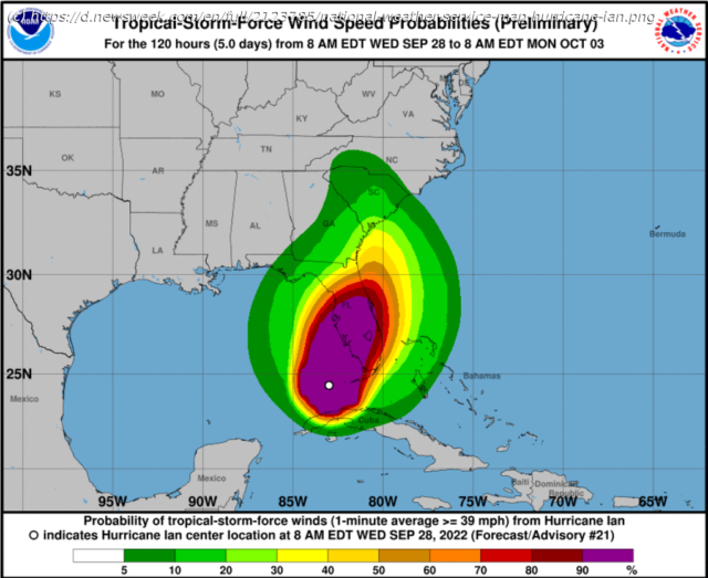
Hurricane Ian is expected to become a category four storm before making landfall in Florida.
Hurricane Ian is forecast to hit Florida on Wednesday as a Category 4 storm, meaning « catastrophic damage will occur, » with maximum sustained wind speeds exceeding 130 miles per hour.
More than 1.75 million Floridians are under mandatory evacuation orders, according to state Governor Ron DeSantis, with 2.5 million residents being advised to flee.
The Tampa Bay region, home to 3 million people, is bracing for what could be its first major hurricane direct hit since 1921.
Storm-surge danger to life warnings are in place across a swath of Florida’s coastline, with flooding also forecast in Georgia and South Carolina.
Ian is now a Category 3 hurricane, with maximum sustained wind speeds « near 120 miles per hour, » according to the National Hurricane Center (NHC).
On Tuesday, it passed over Cuba, knocking out the island’s power grid, with the NHC forecasting further « strengthening » until Ian makes landfall as an « extremely dangerous major hurricane. » According to hurricane specialist Michael Lowry, Ian has increased in size by 50 percent.
The National Weather Service reports tornadoes have been seen in southern Florida, as the hurricane makes its approach.
In its latest ‘key messages’ update, released at 12.
Home
United States
USA — mix Hurricane Ian Path Update, Tracker as 130mph Winds Forecast Before Landfall


