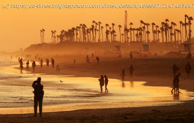
A days-long heat wave is expected to continue across Southern California through the weekend, bringing high temperatures into the triple digits and elevating wildfire danger.
A “heat dome” settling over Southern California is expected to intensify through the weekend, bringing temperatures into the triple digits and elevating wildfire danger.
An excessive-heat warning for the Antelope Valley and foothills will be in effect from 10 a.m. Friday to 10 a.m. Monday, with temperatures between 103 and 113 degrees expected, according to the National Weather Service. Overnight lows could provide little relief, dipping only into the mid-70s to mid-80s.
Temperatures are forecast to peak Friday into Monday in the deserts, lower mountains and interior valleys. Overnight lows are expected to range from the low 70s to 80s in the lower mountains.
For the coastal valleys and Santa Monica Mountains, the heat is expected to peak Friday into Sunday, with highs in the 90s to 105.
The warmest areas will be in the valleys, the San Fernando Valley foothills and the Los Angeles County mountains. Woodland Hills could see a high of 107 degrees on Saturday.
Decades-old daily temperature records are in striking distance over the weekend, according to NWS meteorologist Rose Schoenfeld. Lancaster is forecast to hit 110 degrees Saturday, which would tie a record set in 1972, and 109 on Sunday, which would equal a mark last reached in 1960. Pomona could also see a daily temperature record tied Friday, when the heat is forecast to reach 103 degrees, matching the record set in 1930.
“It’s not a crazy, extreme heat wave or anything,” Schoenfeld said. “It’s a run-of-the-mill heat wave.”
The hot conditions are caused by an area of high pressure aloft over Southern California that began Wednesday, leading to a warm air mass known as a “heat dome” that traps the heat near the surface. The air mass is not expected to mix with other areas, resulting in the air being still and keeping the region warm.
The high pressure is expected to cause compression of the marine layer, keeping it concentrated mostly to coastal areas and away from more inland regions, which will be much hotter.
Home
United States
USA — mix ‘Heat dome’ will hit Southern California with triple-digit highs, fire danger


