Array
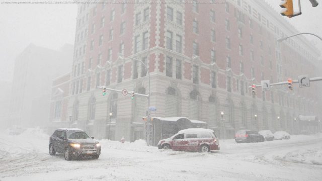
A lake-effect snowstorm dumped several inches of snow over western New York early Friday with snowfall totals expected to reach 4 feet through Sunday in Buffalo.
Eleven counties, which includes Buffalo, remained under a state of emergency Friday morning as an intense snow band whipped the area.
New York state’s Twitter account shared a photo of a yardstick buried in 19 inches of snow in South Cheektowaga west of Buffalo shortly before sunrise. “Continue to stay off the roads and stay safe,” the tweet read.
Weather Channel meteorologist and storm chaser Jim Cantore, who was in the Buffalo area Friday, tweeted a picture of a yardstick showing 32 inches of snow „and counting“ for nearby Hamburg, New York.
“Whether Buffalo city gets 4 feet or not is irrelevant,” the famed weather forecaster told Erie County executive Mark Poloncarz on Thursday. “You’re gonna get something. I mean, Erie is gonna get crushed, as we know.”
Snowfall totals were expected to vary widely due to the peculiarities of lake-effect snow, which is caused by frigid air picking up copious amounts of moisture from the warmer lakes.
Here’s what to know about the snowstorm:
Southern Buffalo was experiencing snowfall rates up to 5 inches per hour Friday in the heaviest part of the snow band, according to AccuWeather senior meteorologist Paul Walker.
Start
United States
USA — mix Buffalo could see 4 feet of snow this weekend amid lake-effect snowstorm:...


