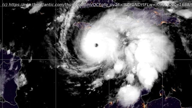
The monster storm is crawling across the Caribbean.
Hurricane Melissa is moving slowly. It reached the coast of Jamaica this afternoon after stalling out over the Caribbean Sea for the past two days. And yet, the winds that form Melissa are shockingly fast. At 10:00 this morning, the National Hurricane Center reported that maximum sustained winds had reached 185 miles an hour—surpassing those of any other storm this year, along with Hurricane Katrina.
That combination of high winds and creeping progress makes Melissa both unusual and unusually dangerous. Over the next day or so, the storm is on track to hammer Jamaica, eastern Cuba, and parts of the Bahamas with catastrophic flash flooding, destructive winds, and damaging waves. Jamaica’s prime minister has warned that the island’s infrastructure cannot withstand such a storm.
Like many other monster storms of the 21st century—and two others this season alone—Melissa intensified rapidly. From Saturday to Sunday, its winds doubled from 70 to 140 miles an hour. A second surge followed from Sunday to Monday, when winds climbed to 175 miles an hour, well above the threshold for a Category 5 storm. Andy Hazelton, a hurricane hunter and modeler at the University of Miami, told me he has been flying morning missions into Melissa’s eye since Saturday. (I am a journalist-in-residence at the University of Miami but have not previously collaborated with Hazelton or any of the other hurricane experts I contacted for this story.) Yesterday morning, turbulence was so intense that his flight had to turn back. “That’s happened in the past.


