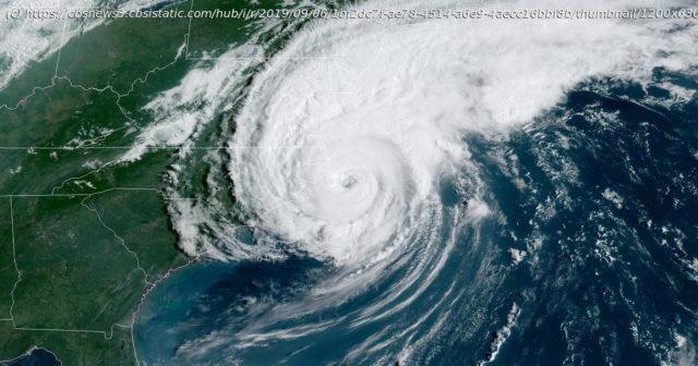
Forecasters say now is the time to start preparing for a season that may bring more than the usual number of major hurricanes.
With just over a week to go before the official start of hurricane season, the National Oceanic and Atmospheric Administration (NOAA) is warning of a very active season to come. The agency said most of the factors considered in preparing the seasonal forecast are pointing to a season of many storms and intense storms.
„NOAA’s analysis of current and seasonal atmospheric conditions reveals a recipe for an active Atlantic hurricane season this year,“ said Dr. Neil Jacobs, acting NOAA administrator.
The forecast from NOAA’s Climate Prediction Center calls for a 60% chance of 13 to 19 named storms (normal is 12). Six to 10 of those could become hurricanes (normal is six) and three to six major hurricanes are forecast (normal is three). A storm qualifies for a name when maximum sustained winds surpass 38 mph; a hurricane has winds of greater than 73 mph, and a major hurricane has winds greater than 110 mph.
This forecast is in line with other seasonal forecasting groups which have also warned of an usually active 2020 hurricane season.
NOAA says that a combination of several climate factors is driving the strong likelihood for above-normal activity in the Atlantic this year. The factors considered include El Niño-La Niña conditions, Atlantic sea surface temperatures, strength of the trade winds in the tropical Atlantic, strength of wind shear in the upper atmosphere, and the state of the West African monsoon season.
El Niño Southern Oscillation (ENSO) conditions in the tropical Pacific Ocean are expected to either remain neutral or to trend toward La Niña, meaning there will not be an El Niño present. The warm water produced in the equatorial Pacific Ocean during El Niño years usually favors active weather in the Pacific and overwhelms the Atlantic Basin. Therefore El Niños typically suppress hurricane activity in the Atlantic, and this summer’s lack of El Niño would typically correspond to an active Atlantic Basin.
If a La Niña forms — meaning cooler tropical Pacific waters — then the Atlantic hurricane season may go even further into overdrive. As of this week, more signs of La Niña are beginning to emerge.
So far this spring, there have been warmer-than-average sea surface temperatures in most of the tropical Atlantic Ocean and Caribbean Sea. If that endures into the height of the hurricane season — August through October — then hurricanes will have more fuel to feed off of.


