This season’s first major storm broke records. How bad will the rest be?
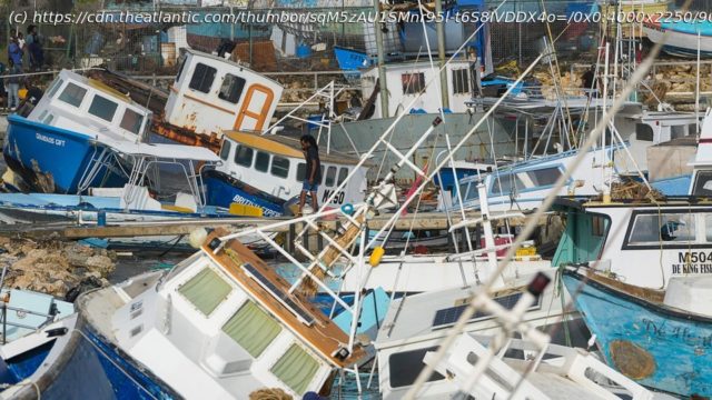
Hurricane Beryl is an unprecedented storm. It’s been nearly 174 years since certain parts of the Caribbean have experienced a storm this brutal. Over just a few days, Beryl has ripped through the region, leaving devastation on the islands in its path. The doors and roofs have been torn off homes. Trees have been snapped in half and branches thrown into the street. Cows have been killed in the fields where they grazed. At least six people have died in the storm, and officials expect the number to rise. According to the prime minister of Grenada, the Category 4 hurricane «flattened» the island of Carriacou, where it made landfall yesterday, in just half an hour. And that was all before Beryl leveled up to Category 5 last night, reaching wind speeds of 165 miles an hour.
Beryl transformed from a tropical depression to a Category 4 hurricane in two days, faster than any hurricane has ever done before the month of September, Brian McNoldy, a senior research scientist at the University of Miami, told me. It is the easternmost hurricane to emerge in the tropical Atlantic Ocean in the month of June. It’s the first storm to strengthen to Category 4 in the Atlantic in June, and now the earliest on record to hit Category 5. Hurricane Beryl “is not normal, in any way, shape, or form,” Ryan Truchelut, a meteorologist in Tallahassee, Florida, who runs the consulting firm WeatherTiger, told me.
We’re only a month into the Atlantic hurricane season, and already, the boundaries that normally govern it are breaking. The cause is abnormally hot ocean waters—warmed by El Niño last year, but also by centuries of burning fossil fuels. Climate change “does not make a storm like Hurricane Beryl exist, but it certainly helped,” McNoldy said.


